


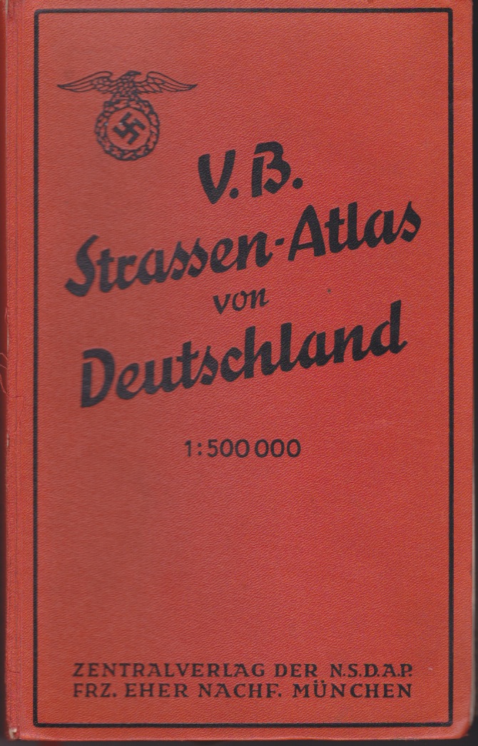
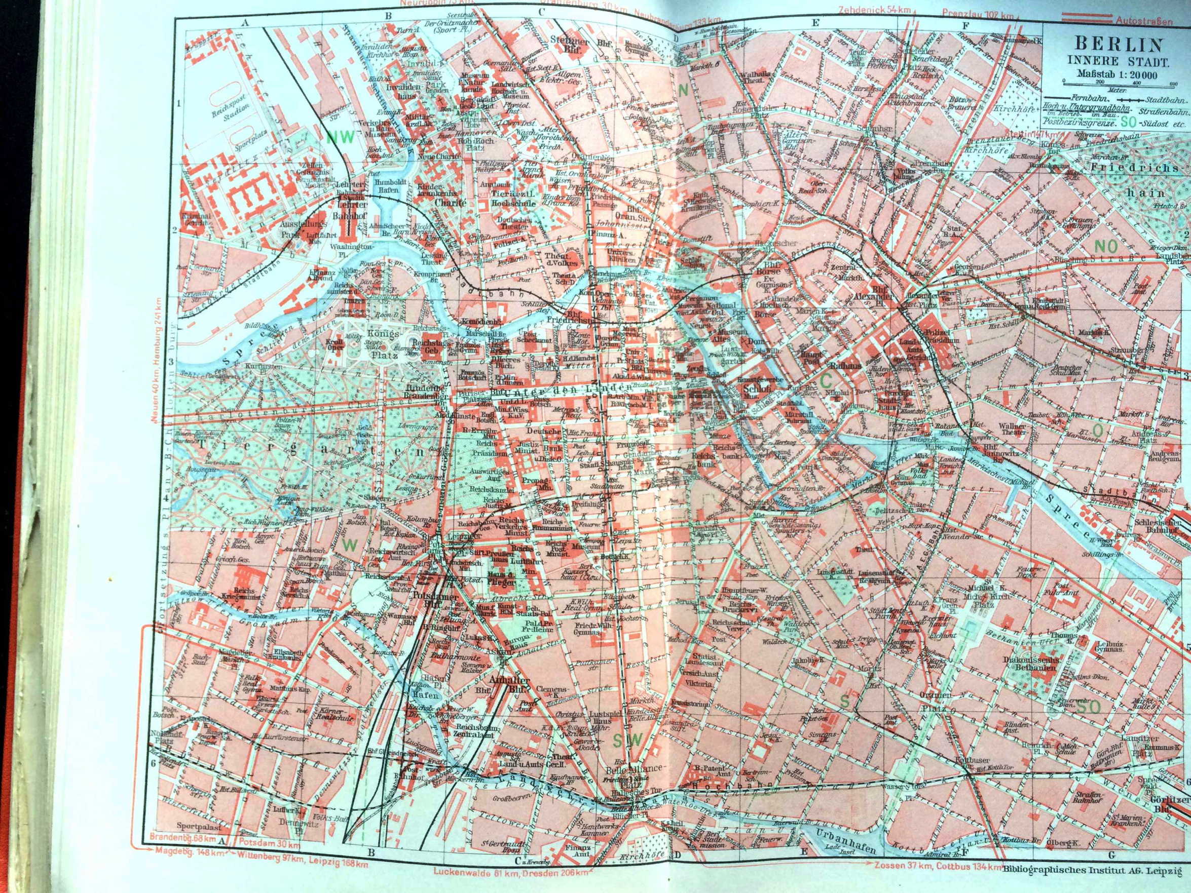
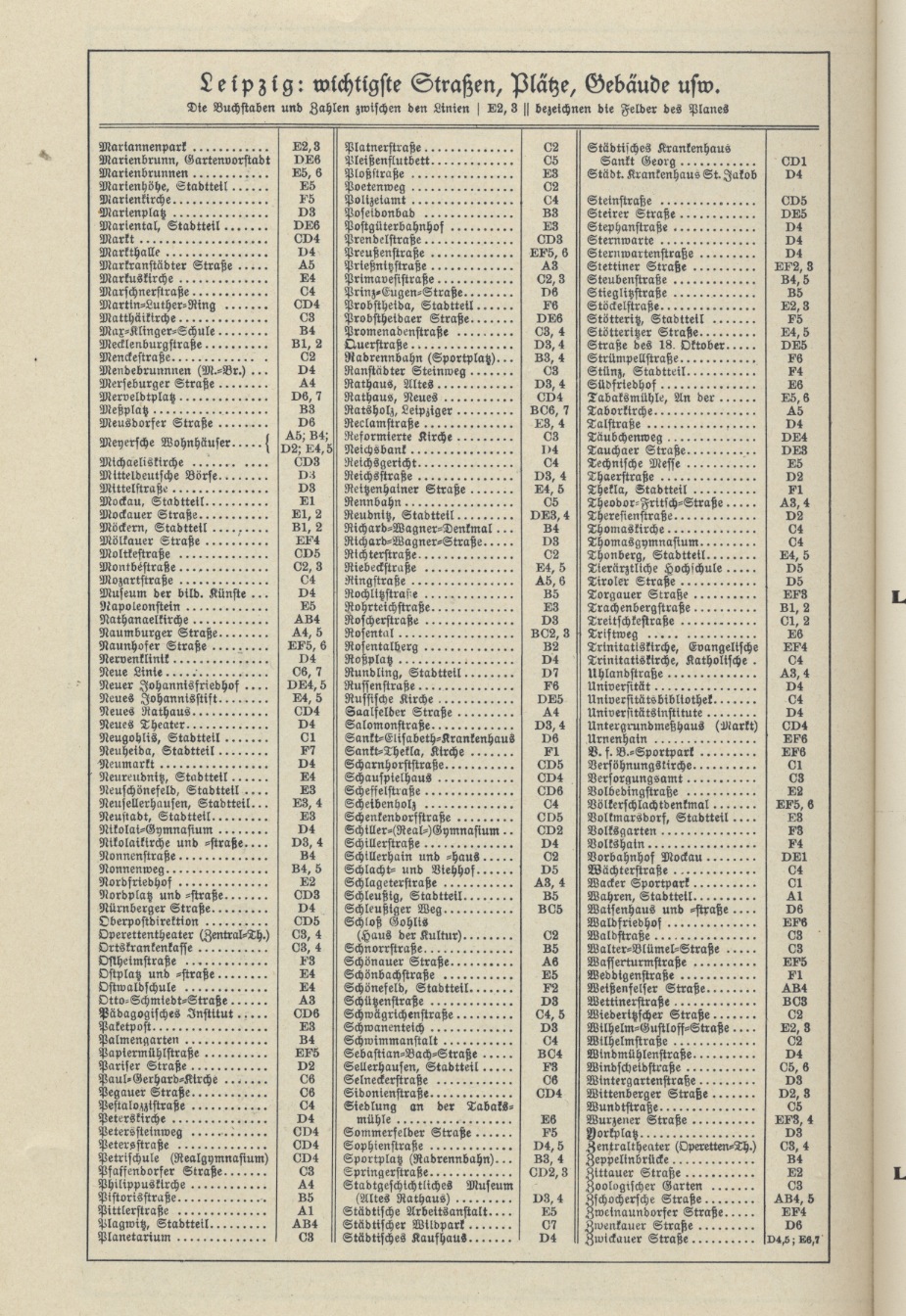
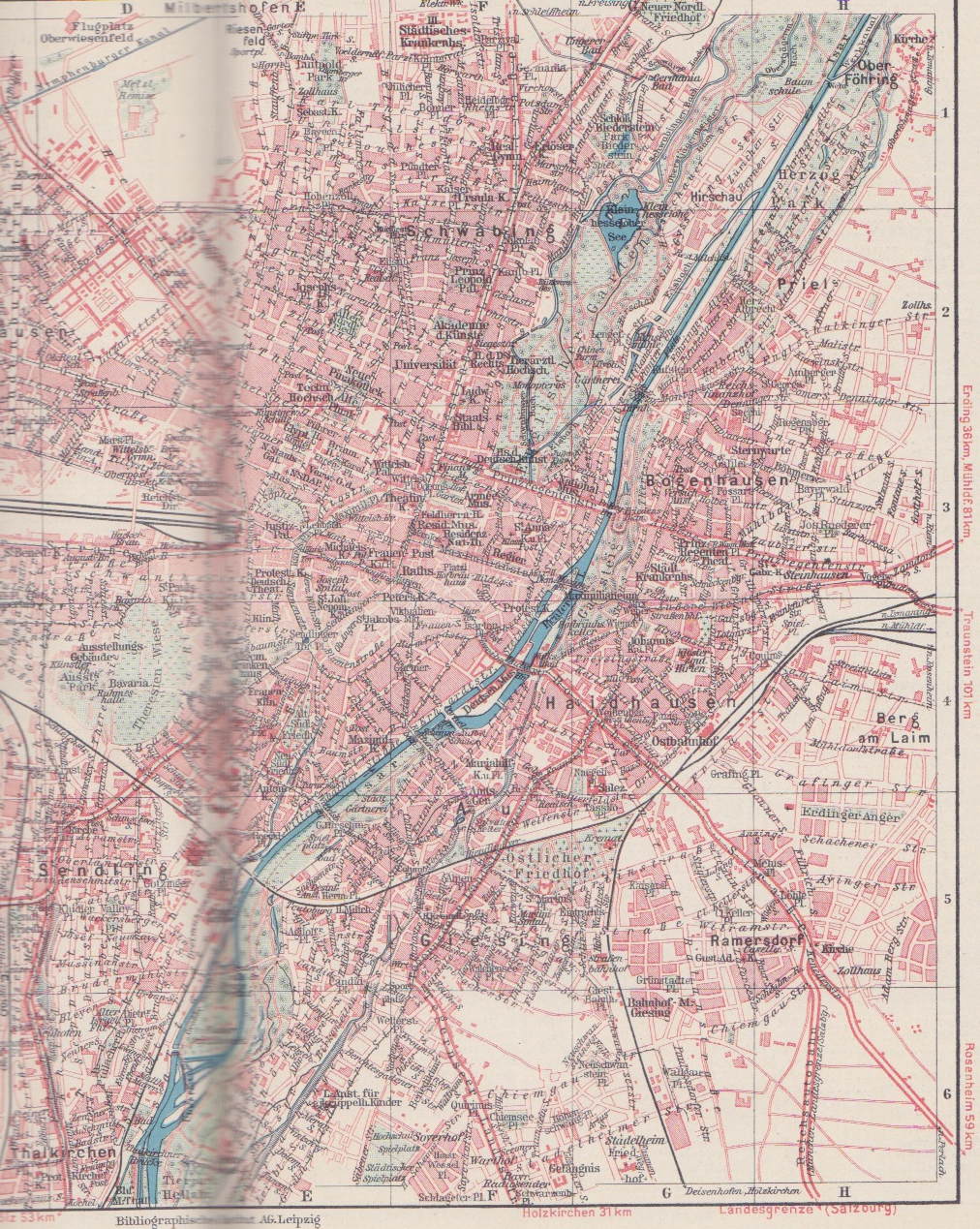
Background: This is an experiment to see if anyone finds it useful. I'm putting four German city maps from 1938, along with the street indexes, on this page. It allows one to see how the Nazis re-named streets and public squares in many German cities. The maps are taken from a German road atlas published by the Nazi Party. If you find this useful, and would like me to add other cities, let me know. The thumbnails are linked to versions that I think will be large enough to use.
The source: V. B. Strassen-Atlas von Deutschland (Munich: Eher Verlag, 1938).
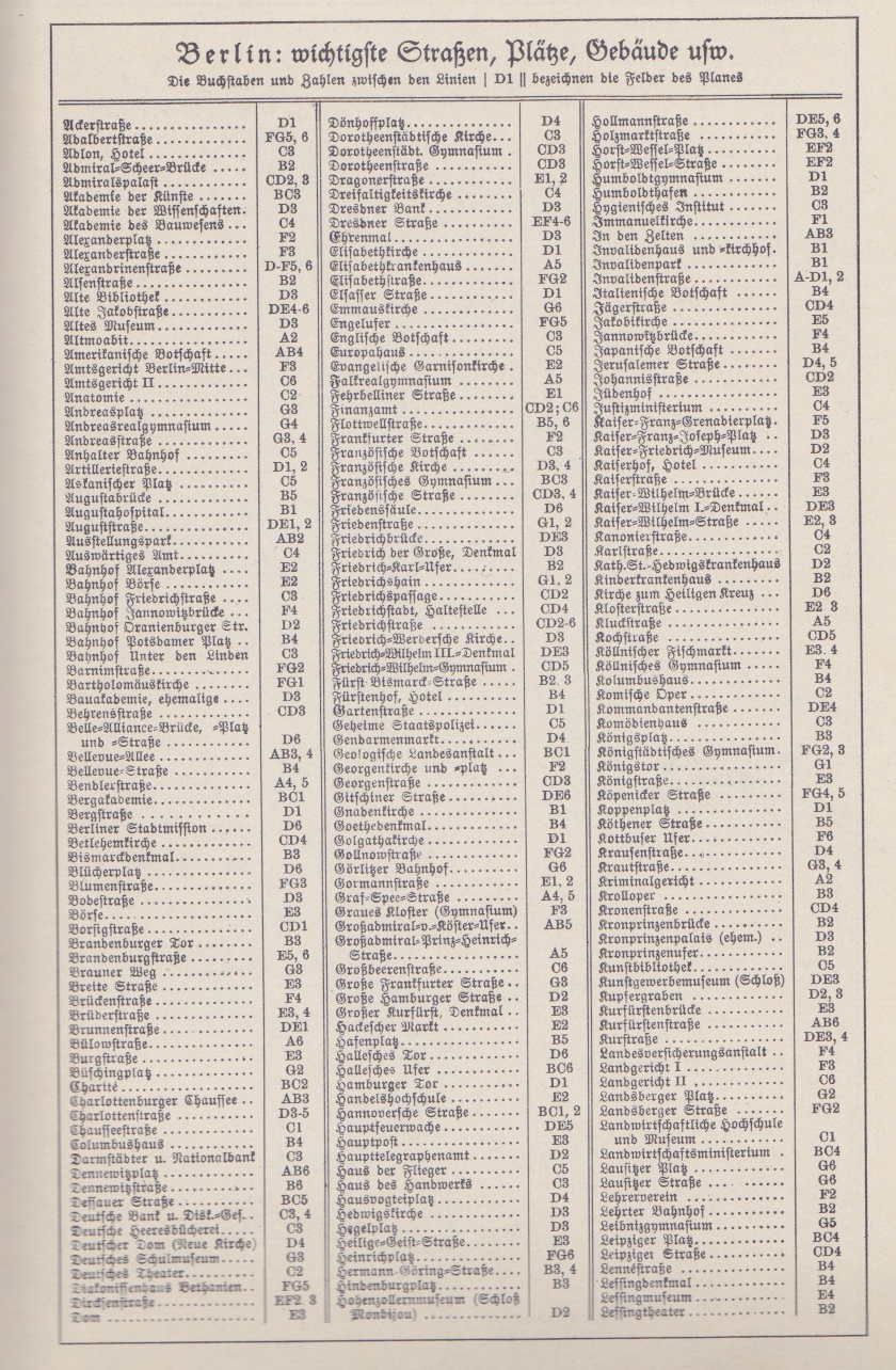
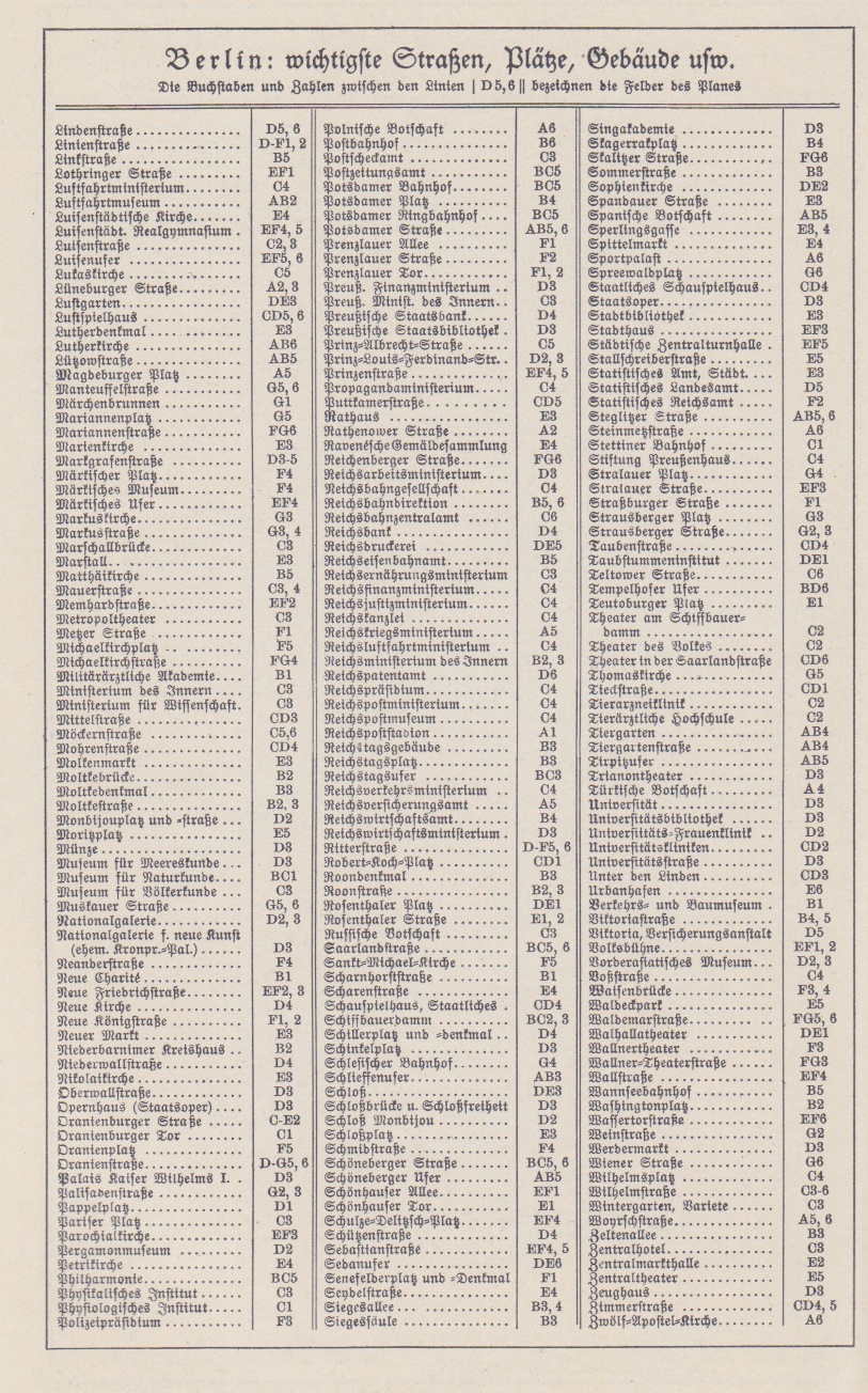
German City Maps from 1938
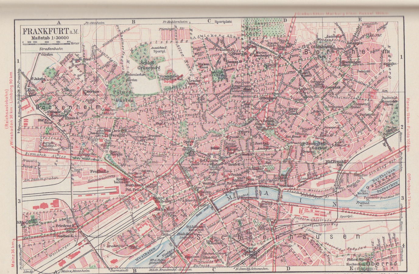
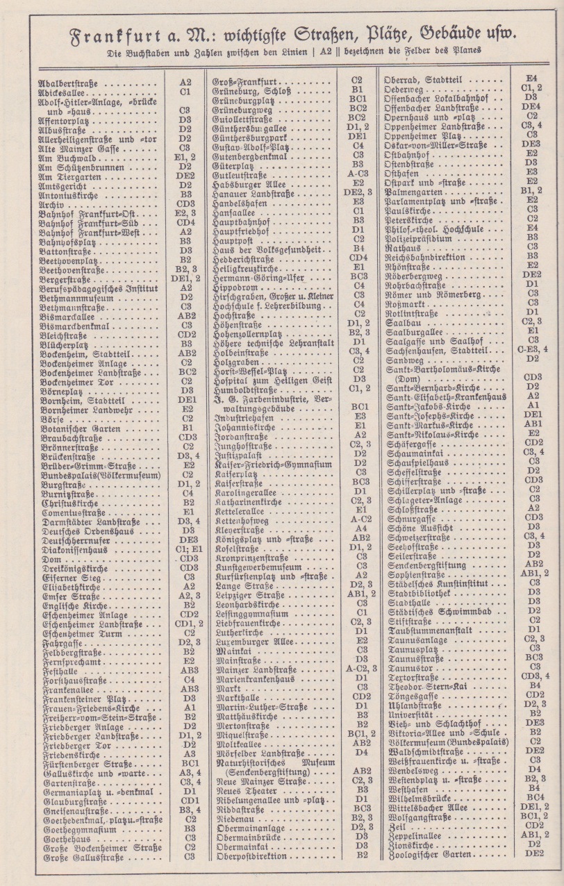
Frankfurt: The index
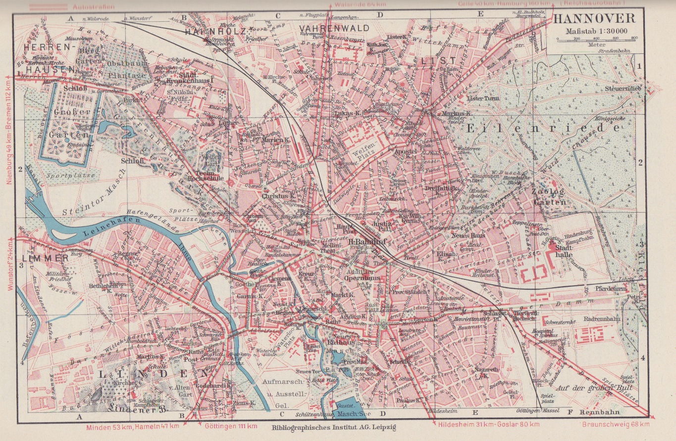
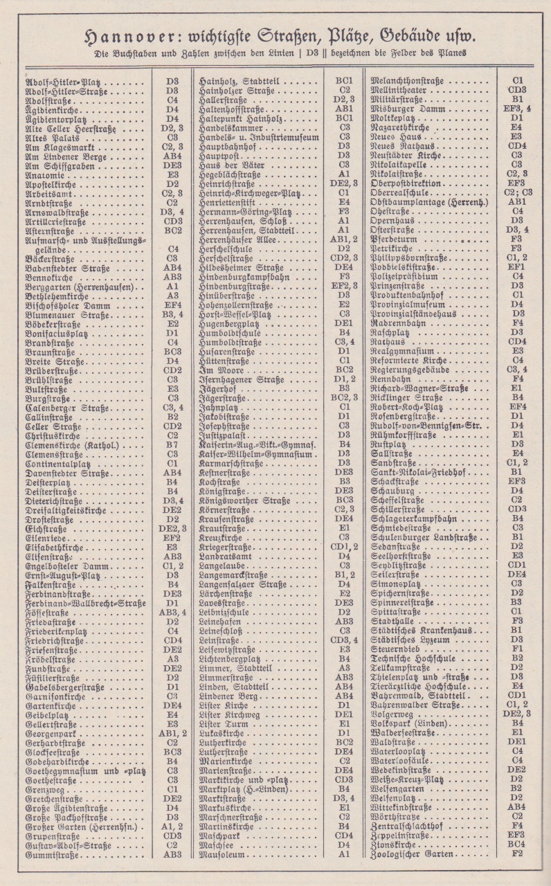
Hanover: The index

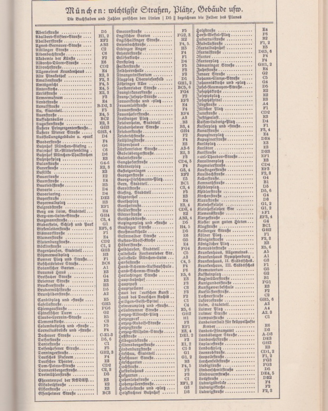
Munich: The index: Page 1 — Page 2
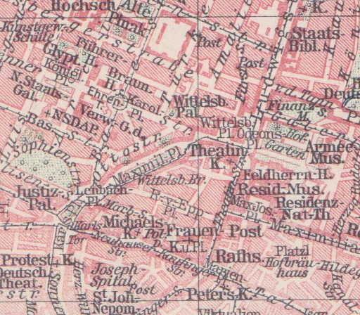
I also include a detail map of the center of Munich showing the location of major party buildings.
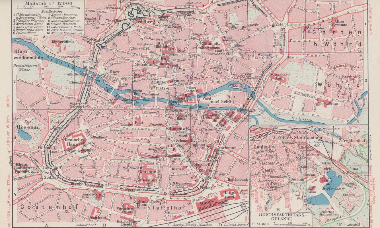
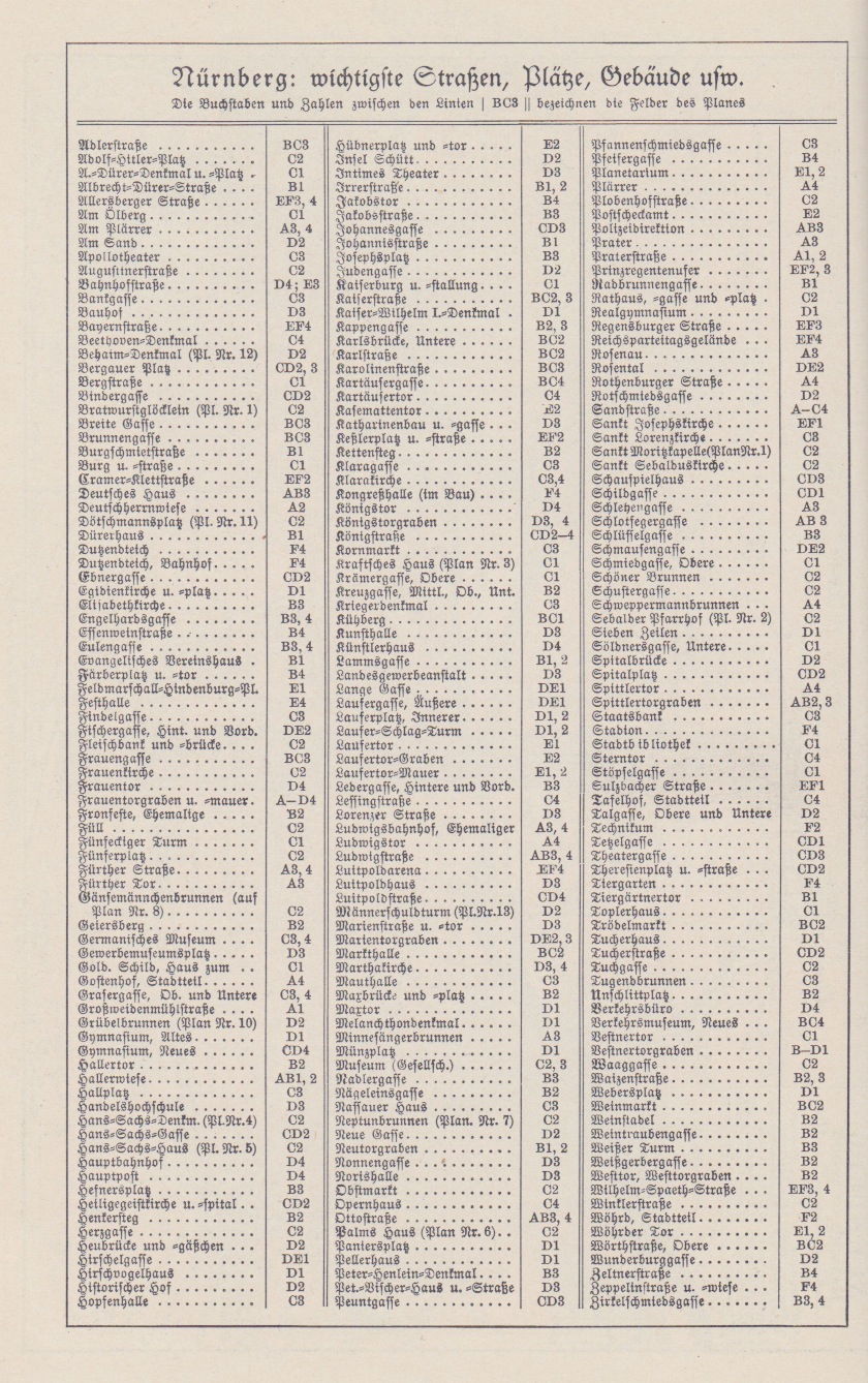
Nuremberg: The index
Last edited 13 April 2026
Go to the 1933-1945 Page.
Go to the German Propaganda Archive Home Page.